

Uncategorized
Spotlight on DelDOT and New Castle County, DE

Welcome to a new year of CSN’s “Stormwater Spotlight”! To kick off 2019, we are heading out to Delaware to learn more about how the Delaware Department of Transportation and New Castle County use their NPDES map viewer to collaborate and manage their stormwater infrastructure.
Maintaining an inventory of thousands of storm drains, outlets and best management practices (BMPs) can require a tremendous amount of dedicated staff time. To help stay organized, many communities are implementing stormwater asset management software to track inspection dates, BMP locations, and citizen complaints. The Delaware Department of Transportation (DelDOT) and New Castle County have recently upgraded their asset management software, the “NPDES map viewer”, to improve their inter-agency collaboration and streamline their workload.
DelDOT and New Castle County were issued their first joint
Phase I MS4 permit for 2001-2006. With that permit, they conducted an initial inventory
of stormwater assets and created the NPDES map viewer to help track them into
the future. Over time, their inventory expanded – thanks, in part, to new MS4
requirements and the Chesapeake Bay TMDL. Today, DelDOT is responsible for
managing 45,000 pipe inlets, 7,200 pipe ends, 3,000 swales and 370 BMPs within
the road right-of-way in New Castle County alone. In addition, the County is
responsible for an additional 2,300 BMPs in public and private open spaces.
The NPDES Map Viewer
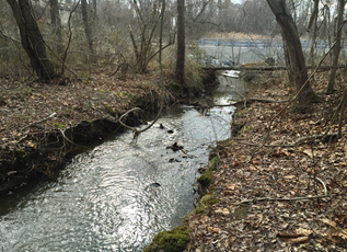
The new NPDES map viewer is an all-in-one tool that geo-references each stormwater asset managed by DelDOT and New Castle County. DelDOT and New Castle County decided to build a custom inventory database using KCI Technologies, rather than using an off-the-shelf product such as Arc Collector. This customization allows for advanced queries to filter the inventory. The tool is flexible and includes all the information staff need to inspect and maintain old BMPs, as well as plan new implementation. Thanks to the strong philosophy of collaboration and coordination between DelDOT and the County, both the stormwater collection system and their BMP inventory are integrated within the map viewer. Both entities are then able to input their data into the system with consistent formatting and QA/QC so that the automatically generated reports can be sent to the state for their MS4 annual report.
The tool has a number of uses that allow staff in different departments
to coordinate efforts and track them for future reporting. For example, field
crews can pull inspection reports for any asset to see if a new inspection is
needed. If an asset requires a new inspection, crews can take a live version of
the tool out to the site and provide notes on any needed maintenance, and
photos of the current condition. Any maintenance needs will then be integrated
into their work order tracking system. The current work order tracking system
is being transitioned to a geospatial platform, which will fully integrate with
the Map Viewer to provide a powerful tool for the maintenance staff to look
over the drainage area prior to fulfilling work the work order. DelDOT and New
Castle County staff are using the tool for developing their water quality
improvement plans. In conjunction with other planning tools, the viewer can
help identify important features such as drainage areas, land ownership, and prime retrofit
opportunities based on the age and condition of an existing BMP.
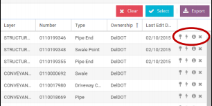
But the NPDES map viewer isn’t just about inspecting and maintaining BMPs and infrastructure. It is also a helpful tool for fielding drainage complaints, and identifying and tracking outfalls for illicit discharge detection and elimination (IDDE). When citizens call the County or DelDOT to report a drainage complaint or potential illicit discharge, staff can use the tool to search the address of the reported discharge and perform a quick desktop analysis to identify stormwater flowpaths and schedule a follow-up site investigation when needed.
Moving forward, there are even more opportunities to expand
the benefits of the map viewer. The plan is to eventually expand the tool to
include information on DelDOT maintenance yards (covered under an industrial
permit) and construction site erosion and sediment control inspections. DelDOT
and New Castle County are also hoping to continue adding data on assets managed
by the smaller cities and townships within the State. Those smaller communities
can integrate their data into the viewer, with QA/QC help from a shared vendor,
and access their own version of the tool.
While this tool was designed to meet the unique needs in
Delaware, many communities are beginning to make use of similar asset
management tools. With an ever-increasing number of stormwater assets to track,
maintain and report, it is valuable to think about how your community is
handling its data and whether it meets your needs. Thinking about the data you
want to track, how you want to use it and who you’d like to have access are
critical steps that will save time and effort in the future.
If you’d like to learn more, you can check out the NPDES Map Viewer here: https://www.deldot.gov/Programs/stormwater/index.shtml?dc=mapviewer
Latest Resources
View All ResourcesDeveloped by the Virginia Department of Conservation and Recreation, this design specification (updated 2013) provides guidance on disconnecting rooftop runoff...
Developed by the Virginia Department of Conservation and Recreation, this design specification (Version 1.9, March 1, 2011) provides guidance on...
Developed by the Virginia Department of Environmental Quality, this design specification (Version 2, 2013) provides guidance on using grass channels...